
Troy Shantz
It’s an unassuming lump of yellow-painted concrete near the Duc d’Orleans dock, but people strolling along Sarnia’s riverfront seldom give it a passing glance.
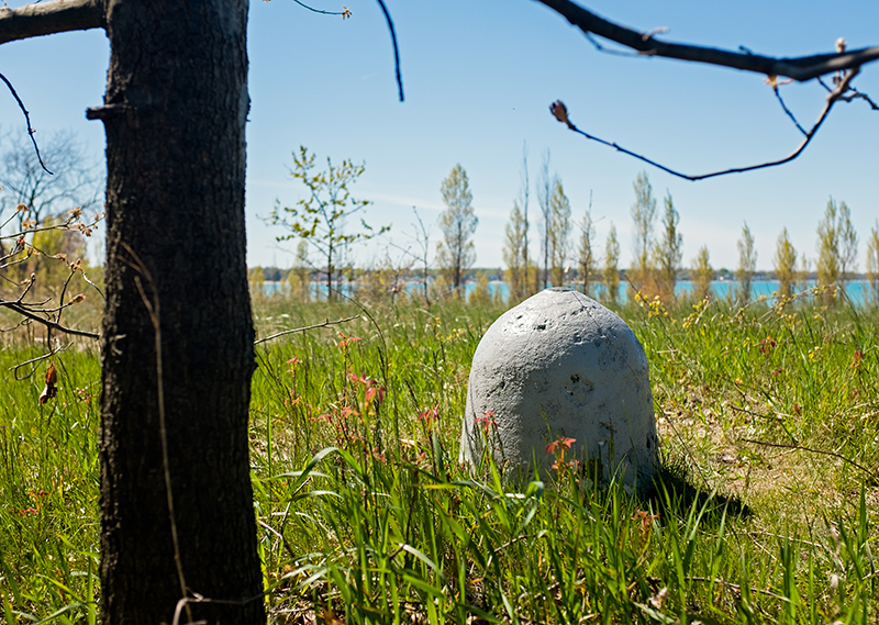
Officially known as “RM 53-82,” it’s one of nine similar lumps strewn along the Canadian shoreline between Sarnia and Mooretown.
So what’s up with that?
The dome-shaped markers are actually used to determine exactly where Canada stops and the U.S. begins.
Most of the international border between the two nations — some 5,061 kilometers of it — runs through field, forest and tundra and is identified by a series of lines intersecting more than 5,000 boundary monuments.
But where the international boundary cuts across water — another 3,830 kilometers of it — the exact location is determined by 2,457 land-based markers like those on Sarnia’s waterfront.
For example, marker RM 53-82 is a specific reference point for a turning point in the St. Clair River known as TP211.

Reference marker RM 53-82 is on Sarnia’s waterfront boardwalk between the Duc d’Orleans II dock and George Street.
Troy Shantz
The markers were erected and are maintained by the International Boundary Commission, and even today they are the gold standard by which the international border is determined and legal disputes are resolved, said Daniel Fortin, Canada’s jurisdiction manager on the Commission.
“One can maybe say that those points are becoming obsolete because we have coordinates, we have GPS, all that kind of stuff,” he said.
“But it’s really the physical marks that are the official references … for the boundary.”
The Commission was established in 1908 when the U.S and the United Kingdom on Canada’s behalf signed a treaty and then appointed their own geographer or surveyor to serve on it.
Canada’s current commissioner is Peter J. Sullivan while Kyle K. Hipsley represents the U.S.
The Commission maintains the invisible, 8,891-kilometre line that stretches from the source of the St. Croix River on the East Coast to the Juan de Fuca Strait on the Pacific Ocean.

The top of reference marker 53-82 on Sarnia’s waterfront.
Troy Shantz
Separating Alaska from B.C. and the Yukon is another line that begins at the Dixon Entrance, passes over the summit of Mount St. Elias and runs north to the Arctic Ocean.
The Commission is responsible for ensuring the markers are undamaged and have a clear vista of six metres, which requires that grass and trees be trimmed as needed.
Fortin said the markers in Sarnia are inspected every five to 10 years, and there is no rhyme or reason for the colour they are painted.
“I would make a joke that the yellow paint was cheaper that day,” he said.

Cyclists pass a reference marker on Sarnia’s waterfront that directly correlates to a specific turning point of the Canada-U.S. border in the St. Clair River.
Troy Shantz

A colourful design has been added to this reference marker on the property of Purdy’s Fishery in Point Edward.
Troy Shantz

Many reference markers are on private property, like this one near Imperial Oil in Sarnia. International Boundary Commission officials pay an inspection visit every five to 10 years.
Troy Shantz