
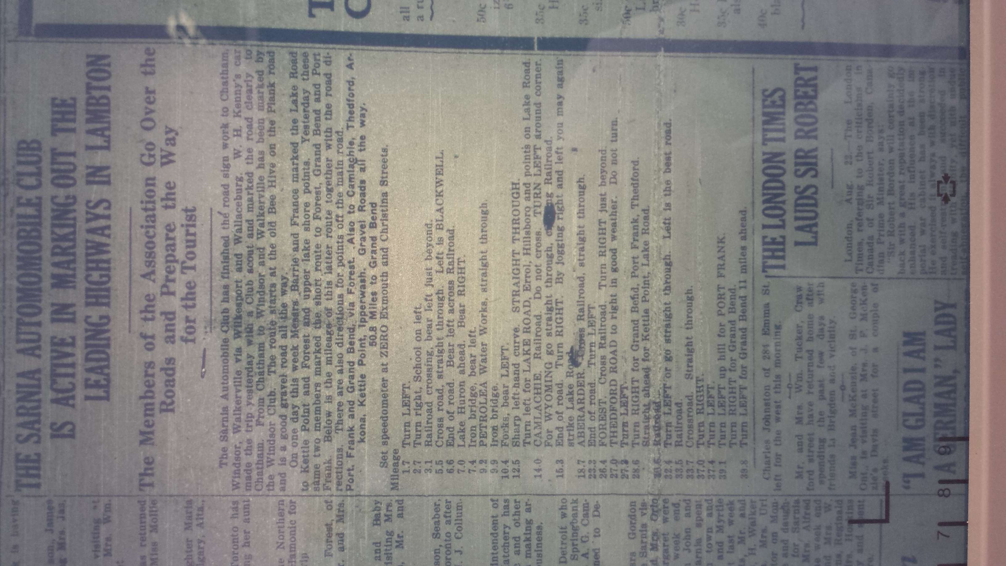
The Members of the Association Go Over the Roads and Prepare the Way for the Tourist
Sarnia Observer: August 22/1918
The Sarnia Automobile Club has finished the road sign work to Chatham, Windsor, Walkerville via Wilkesport and Wallaceburg. W.H. Kenny’s car made the trip yesterday with a Club scout and marked the road clearly to Chatham. From Chatham to Windsor and Walkerville has been marked by the Windsor Club. The route starts at the old Bee Hive on the Plank road and is a good gravel road all the way.
One one day this week Messrs, Barrie and France marked the Lake Road to Kettle Point and Forest and upper lake shore points. Yesterday these same two members marked the short route to Forest, Grand Bend and Port Frank. Below is the mileage of this latter route together with the road directions. There are also directions for points off the main road.
Port Frank and Grand Bend, via Forest. Also to Camiachie, Thedfor, Arkona, Kettle Point, Ipperwash. Gravel Roads all the way.
50.8 Miles to Grand Bend
Set speedometer at ZERO Exmouth and Christina Streets.
Mileage
1.7 Turn Left.
2.7 Turn right, School on left.
3.1 Railroad crossing, bear left just beyond.
5.5 Cross road, straight through. Left is BLACKWELL
6.6 End of road. Bear left across Railroad.
7.0 Lake Huron ahead. Bear RIGHT.
7.4 Iron bridge, bear left.
9.2 PETROLEA Water Works, straight through
9.9 Iron bridge
10.4 Forks, bear LEFT
12.5 Sharp left-hand curve. STRAIGHT THROUGH.
Turn left for LAKE ROAD, Errol; Hillsboro and points on Lake Road
14.0 CAMLACHIE, Railroad. Do not cross. TURN LEFT around corner.
For WYOMING go straight through, [crossing] Railroad
15.3 End of road. Turn RIGHT. By jogging right and left you may again strike Lake Road.
18.7 ABERARDER. Cross Railroad, straight through.
23.3 End of Road. Turn LEFT.
26.4 FOREST. Cross railroad. Turn RIGHT just beyond.
27.0 THEDFORD ROAD to right in good weather. Do not turn.
27.2 Turn LEFT.
28.6 Turn RIGHT for Grand Bend, Port Frank, Thedford. Straight ahead for Kettle Point, Lake Road.
30.6 Railroad.
32.4 Turn LEFT or go straight through. Left is the best road.
33.5 Railroad.
33.7 Crossroad. Straight through.
37.0 Turn RIGHT.
37.4 Turn LEFT.
39.1 Turn LEFT up hill for PORT FRANK. Turn RIGHT for Grand Bend.
39.8 Turn LEFT for Grand Bend 11 miles ahead.
This story was researched and re-typed by our coop student, Katie Braet in 2016.
To find more information about road maps in Ontario, Steve Loxton suggests this page!
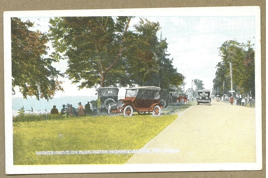
Here is a view of some of the paths a driver would see if they took the route back in 1918.
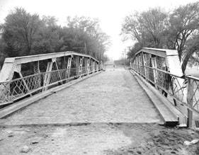
Cull Drain Bridge
Stopping off for some lunch!